I have had the great fortune to run and hike thousands of miles in the Shenandoahs. I love this National Park and am always thrilled to share it with others, so I wrote up some of the greatest hits in the Central Shenandoah district. Happy trails!
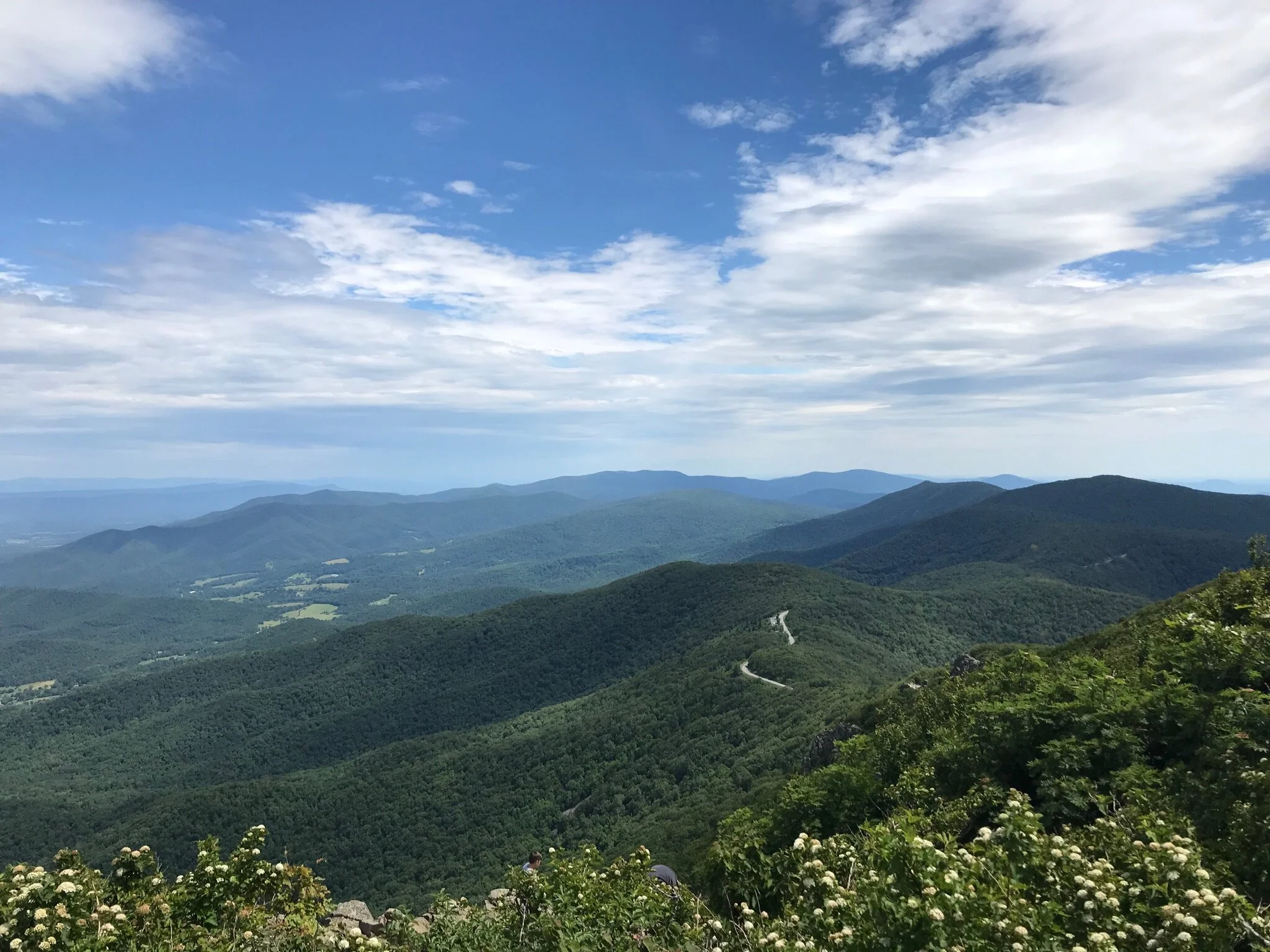
Stony Man (Great for Families)
Length / Ascent / Difficulty: 1.6 miles / 325 feet / Easy
Start: Skyline Drive mile 41.7 (10mi south of Thornton Gap)
Description: Stony Man is a 4,000+ foot summit with terrific views from the rocky summit. This is a relatively easy hike with nearby parking - high reward to effort! You can stop by Skyland ranch before / after for a bite to eat, and this can easily be combined with Hawksbill, which is a few miles down Skyline Drive.
Directions: Start at the Passamaquoddy parking lot near Skyland Ranch (10 miles south of Thornton Gap). Take the Appalachian Trail. After .4 miles, the AT turns right, but you continue straight for the summit. Return the same way and note there are a few trails between the AT and the summit, but they get you to the same place.

Limberlost Trail (Great for Families)
Length / Ascent / Difficulty: 1.3 miles / 98 feet / Very Easy
Start: Skyline Drive mile 43 (~11mi south of Thornton Gap)
Description: full accessible loop trail with finely crushed gravel. Stroller friendly and wheelchair accessible. There are numerous benches along the trail that make for great picnic spots!
Directions: start at the Limberlost parking lot near mile market 43 on Skyline Drive, just south of Skyland Ranch. It is a loop trail that can be started in either direction.

Little Stony Man (Great for Families)
Length / Ascent / Difficulty: Just under 1 mile / 200 feet / Easy
Start: Skyline Drive mile 39 (8mi south of Thornton Gap)
Description: Little Stony Man provides a beautiful overlook that is close to the trailhead.
Directions: Go south on Skyline Drive and park at the Little Stony Man lot near milepost 39. There is a helpful map at the trailhead that shows the route. Turn left / south on the Appalachian trail. When you hit a junction, turn right to the overlook rather than continue left on the AT. Return the way you came. If you still have energy, you can add more distance on the AT, which comes to another nice overlook before too long.

Miller’s Head (Great of Families)
Length / Ascent / Difficulty: 1.6 miles / 350 feet / Easy - Moderate
Start: Skyline Drive mile 42.5 (11mi south of Thornton Gap)
Description: Hidden gem out-and-back to Miller Head Lookout Tower with panoramic views
Directions: take the South entrance to Skyland Ranch at mile 42.5. After the stables and about .25 miles, take a left. Soon you’ll see the amphitheater with a grassy parking area on the left. Look for the Miller Head Trailhead.

Pass Mtn Loop (Great for Families)
Length / Difficulty: .25 miles / Easy
Start: Skyline Drive mile 30 (1mi north of Thornton Gap)
Description: this is an easy .25 mile loop with a few nice views. It is a great way to get energy out with little ones and explore nature without committing to a big hike. After finishing the loop, you can also do it in reverse to make it .5 miles.
Directions: go north on Skyline from Thornton Gap. Your first overlook on the left is Pass Mtn Overlook after a few miles. Park here, and you will see signs for the Pass Mountain Loop.

Thornton Gap Appalachian Trail
Length / Difficulty: variable, out & back / Moderate northbound, Difficult southbound
Start: Skyline Drive mile 31 (accessible from Route 211)
Description: hike on the Appalachian trail northbound to Pass Mountain or southbound towards Mary’s Rock. Northbound is more gradual while southbound is rocky and steep. This route is accessed outside of Skyline Drive so is a great option when the road is closed for inclement weather!
Directions: right turn into the parking lot when on 211 heading East just before you hit the Skyline Drive turnoff. Walk to the very back of the parking lot to find the trailhead. After 100 yards, turn left to go south towards Mary’s Rock or right to go north towards Pass Mtn (and crossing 211 / Skyline by foot).

Mary’s Rock
Length / Ascent / Difficulty: 3.1 miles / 800 feet / Moderate
Start: Skyline Drive mile 33.5 (2mi south of Thornton Gap)
Description: Mary’s Rock offers one of the best views in the Shenandoahs. As you ascend to the AT, you pass the ruins of a stone house that predates the national park. There are several nice viewpoints along the AT on the way to Mary’s Rock.
Directions: Start at Meadow Spring Parking (2mi south from Thornton Gap). Cross Skyline Drive and ascend Meadow Spring trail for .7 miles. Turn right on the AT for .7 miles. At the intersection, turn left for Mary’s Rock summit. Return the way you came!

Pinnacles
Length / Ascent / Difficulty: 2.5 miles / 650 feet / Easy - Moderate
Start: Skyline Drive mile 36.4 (5mi south of Thornton Gap)
Description: Out and back along the Appalachian Trail. Starts with great views through a meadow and after climbing up to Pinnacle Peak, there is an amazing hidden gem overlook.
Directions: Park at the Jewell Hollow Overlook. In the back right, there is a short spur to the AT. Go right / south through the meadow and up towards Pinnacle Peak. After about 1.2 miles and shortly after reaching the top, you reach a stunning, unmarked overlook on the left with views of Mary’s Rock. Return the way you came.

Neighbor Mtn
Length / Ascent / Difficulty: 2.8 miles / 700 feet / Moderate
Start: Skyline Drive mile 28 (3mi north of Thornton Gap)
Description: starts with a steep half mile up a fire road to the Byrd’s Nest shelter. Descend the Neighbor Mtn trail to the Appalachian Trail, which has great views during winter. Save the best for last with a meadow and great overlooks to finish.
Directions: shortly after Beahm’s Gap going North on Skyline, there is a parking lot on the right. Cross the road to go up the Neighbor Mtn fire road. Continue past Byrd’s nest shelter on the yellow / Neighbor Mtn trail. After 1 mi total hiking, turn left for a .1 mile spur to the AT. Left on the AT for 1.2 miles and back across Skyline Drive. Right after crossing skyline, left on Rocky Branch Trail and .4 miles to the finish.

Hawksbill Loop
Length / Ascent / Difficulty: 2.7 miles / 750 feet / Moderate
Start: Skyline Drive mile 45.5 (14mi south of Thornton Gap)
Description: Hawksbill summit is over 4,000 feet and the highest point in the Shenandoahs! The initial climb is steep, but the views from the top are well worth it. The return from the summit is more mellow and covers a nice section of the Appalachian Trail.
Directions: start at Hawksbill Gap Parking (14 miles south of Thornton Gap) and ascend lower Hawksbill trail, which takes you to the summit in a steep .7 mile climb. When returning from the summit, after you pass the shelter bear right rather than return the way you came. Bear right again (do not take the fire road), and follow signs to the Appalachian Trail. Turn right on the AT and continue for ~1.5 miles. At the next junction, turn right on the 100 yard spur back to parking.

Whiteoak Canyon Upper Falls
Length / Ascent / Difficulty: 4.8 miles / 1040 feet / Moderate
Start: Skyline Drive mile 42.5 (11mi south of Thornton Gap)
Description: Whiteoak Canyon has one of the largest waterfalls in the Shenandoahs. Steady, moderate hike down the mountain from Skyline Drive with several bridge crossings over streams. Turn around at the Upper Falls overlook (make sure not to keep going as it gets very steep beyond the falls!) and a long, steady uphill back.
Directions: parking lot at Limberlost trail near mile 43 of Skyline Drive. There are several side trails, but just follow the main Whiteoak Canyon trail down and back.

Mary’s Rock via Buck Ridge
Length / Ascent / Difficulty: 8.8 miles / 2700 feet / Hard
Start: Buck Ridge Trailhead (3.7 miles east of Thornton Gap on 211)
Description: This route also goes to Mary’s Rock but via the steep Buck Ridge trail that starts outside of the Shenandoah Park.
Directions: Park at the Buck Ridge Trailhead (on Google maps if you have service) between Thornton Gap and Sperryville off 211. After .25 miles and a few creek crossings, you turn left on the Buck Ridge Trail, which is very steep at the start! After 3 miles you will arrive at Meadow Spring parking on Skyline Drive. The next section mirrors the Mary’s Rock route above. After returning from this section, take a left down Buck Hollow Trail rather than Buck Ridge. This makes the bottom section a nice 6 mile loop. After a little under 3 miles, you will pass the Buck Ridge junction and continue straight to finish.