I’ve been fortunate to have some epic running adventures around the world, but it isn’t easy to find reliable information on the best routes and trails, especially when coming from out of town. Hopefully this helps you in your next adventure!
Chamonix

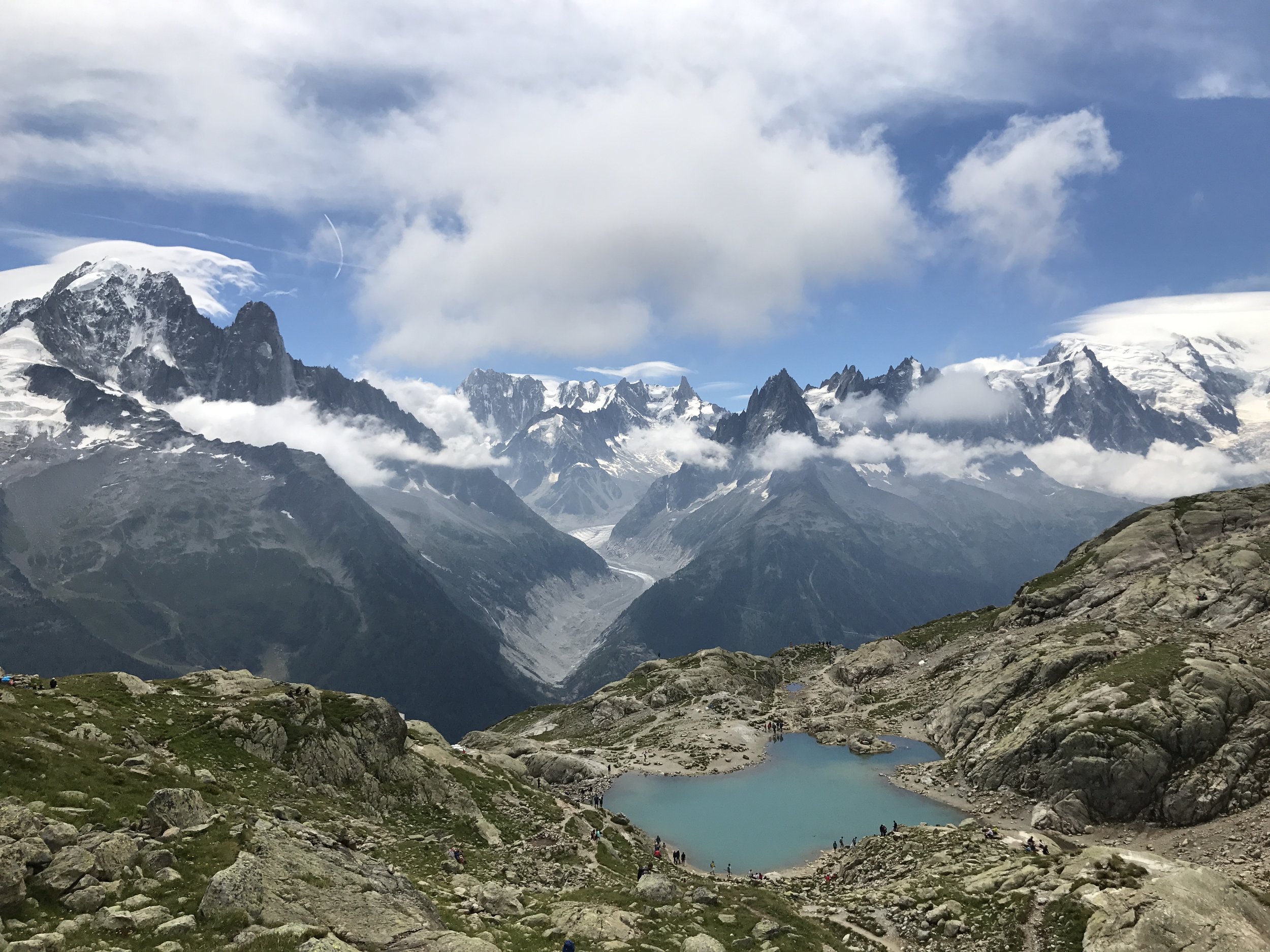
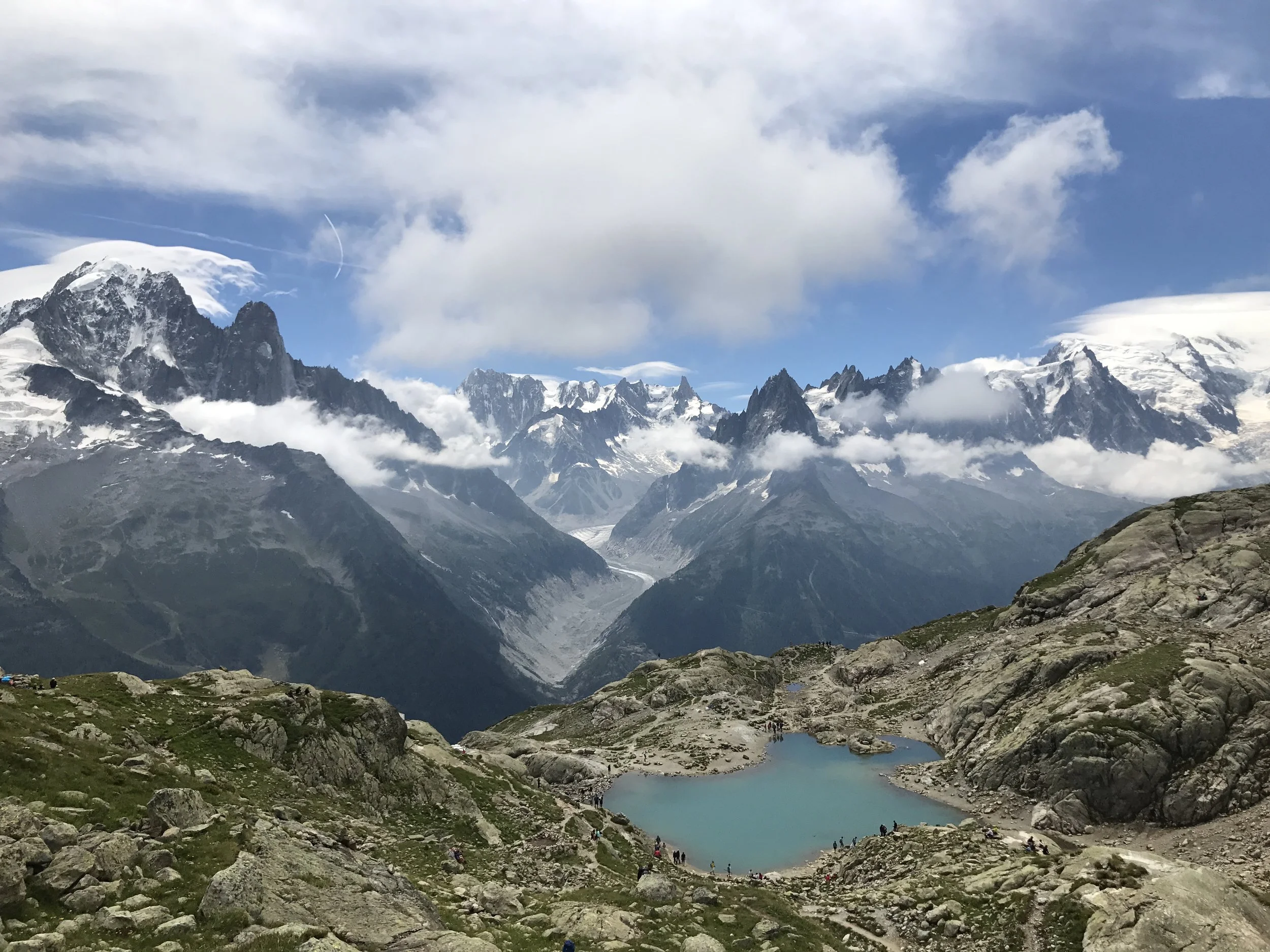
Lac Cornu & Lac Noirs
Lac Cornu is a classic, “must-do” hike in Chamonix. This version starts and finishes at the Plan Praz gondola, though you can also make it point to point by going from the Index lift above Flegere and traversing over to Plan Praz. Ascend to Lac Cornu with non-stop views of the Mer de Glace and les Drus. There are a few technical sections, and you may encounter snow as you go up. From Lac Cornu, continue towards Lac Noirs on an increasingly technical route. The trail will end, and retrace your steps back towards Plan Praz (or continue towards Flegere at the first junction on the way back).

Plan de l’Aiguille
From the town of Chamonix, climb 3 steep miles (20%+ grade) up to the Grand Balcon Nord. The climb has great views of the Aiguilles Rouges on the way up. Shortly after the junction with the Grand Balcon Nord, you arrive at the Refuge Plan de l’Aiguille. You are above treeline here looking up at Aiguille du Midi and Mont Blanc. From here it is 4 slightly less steep miles back down to Chamonix. The route can be extended a towards and bit beyond the Plan de l’Aiguille cable car, and you can also take the cable car up or down to skip one leg of the route.

Scramble to Les Mottets
After a few miles in the valley, cross the river and ascend through the forests below the Mer de Glace. This section starts on marked trail but quickly becomes an unmarked rock scramble. It is technical and dangerous for about a mile, following scattered cairns. You should be confident in your ability as downclimbing is not easy. The scramble section finishes at the Refuge des Mottets, a nice spot for some refreshment with a view. From there descend marked trail following signs to Chamonix. You could also go up from the Les Mottets to Montevers to extend the route.

Grand Balcon Sud
The Grand Balcon Sud is one of the most popular routes in Chamonix. The terrain is accessible and gentle when it comes to the Alps, and this route is suitable for kids and the less adventurous. It traverses the Grand Balcon Sud between Planpraz and Flegere with continual views across the valley towards the Mer de Glace, les Drus, and Mont Blanc. You can start either at Flegere or Planpraz, and you can hike down instead of the cable car / gondala if you want to save some money and extend the adventure. Expect lots of people on the trail in peak season on a sunny day.
Lac Blanc
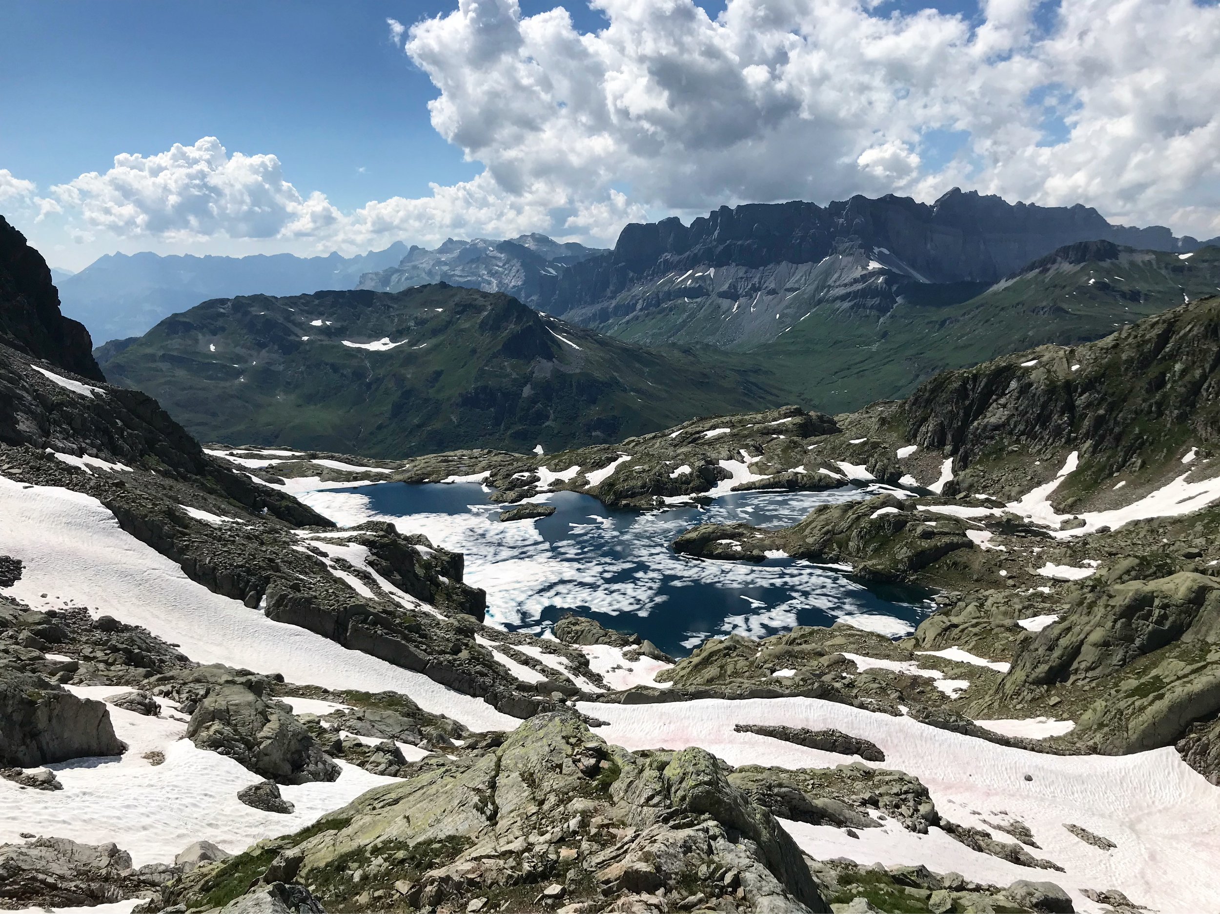
Lac Blanc is a stunning high alpine lake. There are several ways to get there, but our favorite starts by taking the cable car to Flegere followed by the lift up to Index. You traverse a few miles on rocky trails with some technical sections, and you may encounter snow up here. After a few miles, you will arrive at Lac Blanc and the refuge. I highly recommend hiking a bit further up from the refuge for a nice vista looking down on Lac Blanc. A meal at the refuge is highly recommended on a nice day, and from there it is a steep descent back to Flegere.

Col de Balme
4 miles
+300 feet
-1,400 feet
GPX Track
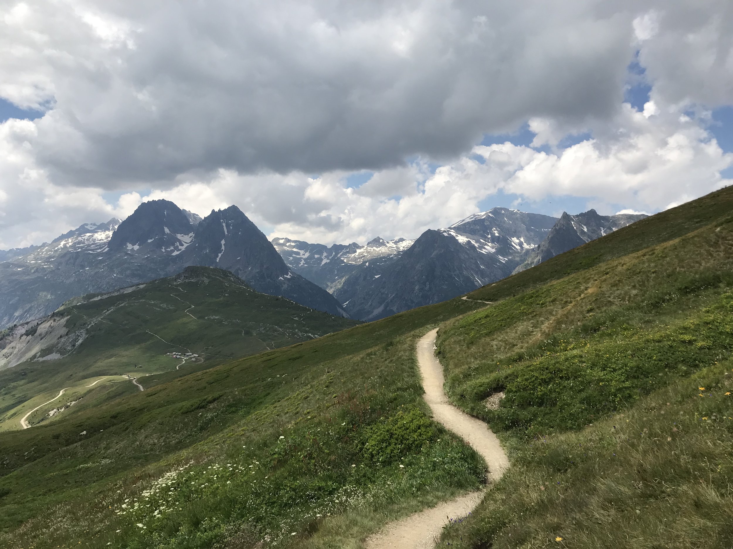
This gem is an easy, family friendly hike. Start at the town of Le Tour and take the Charamillon gondola up followed by the Autanne chair lift. You arrive over 7,000 feet with spectacular views of the valley and Mont Blanc. After a short traverse, you will be standing at the Swiss / French border next to the Refuge Col de Balme. The epic vistas from here make it well worth a stop. Continue past the hut for a lovely descent through wildflowers back towards Charamillon. There is another refuge here where you can stop, and from there either take the Charamillon gondola back down or hike back to the bottom.
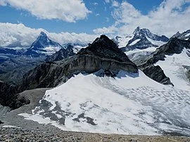
Zermatt

Schwarzee, Hornlihutte, Trockener Steg
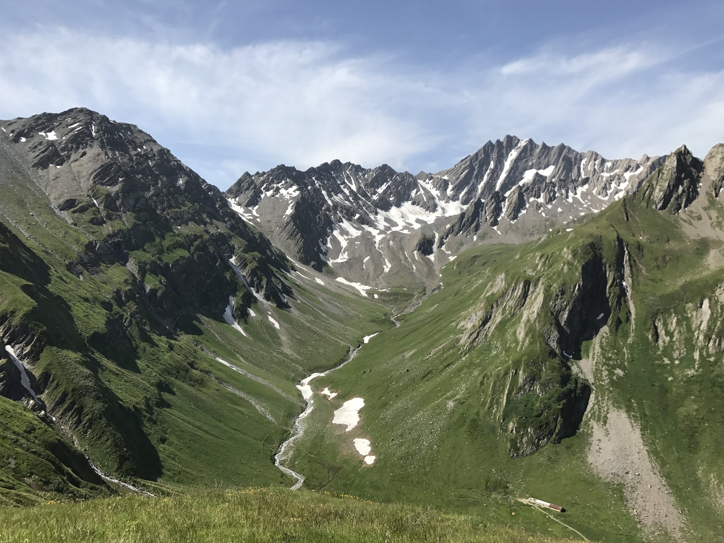
This burly route hits 3 of Zermatt’s gems all in one shot. You start with a 5,000+ foot climb up from Zermatt to Hornlihutte. The trail is steep but not technical up until the halfway point at Schwarzee. The second half is far more technical with exposed sections, scree, and cable assisted climbs. Hornlihutte is tucked in at the base of the Matterhorn and offers spectacular views in a high alpine environment. The descent backtracks at first and turns right around Schwartzee for a short descent followed by the climb up to Trockener Steg. Enjoy the panorama of Monte Rosa on the 4,000 foot descent back to Zermatt.
Platthorn
Courmayeur
This is a demanding, but rewarding route that travels into more remote territory around Zermatt. The trail ascends steeply from Zermatt, past the Edelweiss restaurant and numerous waterfalls. You pass the Trift Bergastthaus and continue into a more open area with an up-close look at glaciers. There is an out and back section to the peak of Platthorn, where you have unparalled views of the surrounding mountains. After the out and back, you descend via a different trail back to the valley.

Grindelwald
The first 2.5 miles features a tough, steep climb through the woods up from Courmayeur, but it is well worth it! From Bertone the views across Val Veny and the Mont Blanc massif are second to none. Continuing on to Refugio Bonatti is well worth it. This is a famous section of the Tour du Mont Blanc and has easy, rolling terrain with jaw-dropping scenery. Follow the same route back and take the time to soak it all in at the refugios.

Faulhorn
The top of Faulhorn offers a panorama with Interlaken on one side and Eiger / Jungfrau on the other. After taking the gondola from Grindelwald to First, the start of the route traverses over to Lake Bachalpsee, a worthy destination by itself. From here, the trail turns up and ascends to Faulhorn. There is a hut at the top that is an excellent location for a break and a meal. Descend down and turn towards Bussalp, where you can take a bus or train back to Grindelwald. You can also backtrack to First and take the gondola or hike down.